City Texture Dashboard
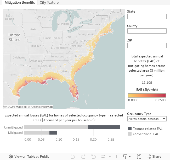
The value of mitigation derives from estimates of avoidable losses. For hurricanes, these estimates are directly influenced by the magnitude and extent of expected wind loads. The maps below illustrate CSHub findings that capture how ‘city texture’—the density and configuration of local buildings—affect wind loads and the derive value of mitigation along the Gulf and Atlantic coasts of the U.S. Explore the dashboard to see the implications of city texture for the resilience planning of regions, states, and, perhaps, your own community.